Tuesday, June 15, 2010

End of Season, TX.


A long, long time ago there was a young graduate student. He participated for several years in DOW field projects prior to Vortex2. One day a DOW broke down and Josh radioed, "We have reached end of season." Navigating the other DOW, unnamed graduate student (we all know who he is!!), looked at his map and asked "Where is End of Season?" At the time, the DOWs were in South Dakota. Vortex2 has reached End of Season, TX.

In short, the people who make up Vortex2 are fabulous. They are people you enjoy working with; they are old friends; they are new friends (I have never been quite sure on semi-colon usage!). As we return back to our "normal" lives, I would like to acknowledge the hard work and dedication of the scientists, engineers, technicians, students, volunteers, hotel coordinator, photographers, and the public. It has been a great run and I wish everyone the best.

Here is to End of Season, TX!
__________________________________________________
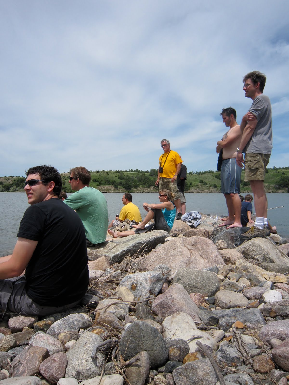
Picture 1: The CSWR crew.

Monday, June 14, 2010

Tornado. Tornado. Big Texan. Flash Ponding.


Once upon a time, in a land far, far away (and without internet), lived a nomadic tribe known as Vortex2...

11 June: Last Chance, CO. Why did the tornado cross the road? Oh wait, it didn't. DOW7 meandered down to Road 2312 (I challenge you to find this road!). The tornado pod teams followed. A tornado formed about 23 km to our west over an open field. The pod teams lined up...and waited. And waited. And waited. And then there was no tornado.

12 June: Spearman, TX. Rain, rain, and more rain.

13 June: After a lovely, rainy evening (and morning) in Liberal, Kansas (home of the National Beef Packing Company. Steak usually is a good dinner choice!) we decided to tackle storms along a remnant outflow boundary from the overnight convection (rain) in the OK/TX panhandles. Basically, we returned to the same location we commenced chasing on the 12th, which was a bit....pondy. So we decided that dirt (mud) roads, were to be avoided. Storm #1 was targeted near Farnsworth, TX. The first storm was, for lack of a better word...boring.
A white rabbit named Harvey (or Frank, depending on your age) appeared in he DOW...yes, it is about that time of the season!
The FC (Field Coordinators--David Dowell and Mike Coniglio; the MCs of the weather world) encouraged us to be optimistic and found us another storm to target. Up came the second storm and it was a good storm! A tornado formed northeast of Booker, TX and DOW7 headed north with the pod teams to intercept. The lack of roads proved to be problematic and we raced east (at safe highway speeds) to to get to another intercept location. After driving through a lot of rain (and a generator failure...), we regrouped to the east as another tornado was forming near Slapout, OK. We tried to get the pods out in front of the tornado, but the path of the tornado was farther south than anticipated...and it dissipated before reaching the road. A few gratuitous pod deployments were made...just because.

I assume that the pod teams will soon mutiny...

So here we are in Amarillo, TX at the same hotel that we ended the season last year...interesting.
________________________________________________________
Picture 1: The super secret PI morning weather briefing.
Picture 2: When in Amarillo...the Big Texan! Only twice this season...a slow year.
Picture 3: The omnipresent, all-knowing FC. And Arby's--Home of the Jamocha shake.
Picture 4: Pretty cloud. I think every single person in Vortex2 took this picture!

Tuesday, June 8, 2010

Venturing a bit north of I-80, one finds:

1. Bluffs
2. Tornadoes
3. Team Howie


On the 7th and the 9th
the greater Scottsbluff area provided us with bluffs. On the 7th, it provided us with tornadoes. And Team Howie was with us all along (they finally crawled out of their radar trucks!).

The 7th was a bit of a challenge because of the usual suspects: multiple storms, fast storm motion, and not many roads. But, despite our nemeses (I would have thought it was nemesi!), we persevered and after a west (Henry, NE), east (Bridgeport, NE), west (Minatare, NE) trajectory on US 26 we deployed. The storm was not looking very interesting on radar (dinner plans were being made...Arby's, Sonic or McDonald's--decisions, decisions...) when, well, it began to look interesting... A weak tornado quickly formed, we moved the pod teams south to get in front of the tornado, but they could not make it in time--the tornado crossed 26 and quickly dissipated. Unfortunately, these weak, short-lived tornadoes are not conducive to pod deployments (slow moving, long-lived wedge, please), but, along with NOXP, we got good radar coverage of the tornado. Additionally, DOW6 got radar data up on (US? NE?)71 in an earlier tornado.

Time to go south...

_______________________________________________________________
Team Howie (as I like to call the group of graduate students that work for Dr. Howie Bluestein):
Picture 1: Jana (left), Mike (right) and Chad (behind). (Chad is not really the radar--he is the radar engineer, but since he was not around, the radar seemed like a good stand-in). Jana and Mike are doctoral students at the University of Oklahoma and operate the mobile phased array radar (which also has a vertically pointing lidar).
Picture 2: (From left to right) Dan, Jeff, and Robin. Technically only Jeff and Robin are Team Howie--Dan is a postdoctoral scientist for CAPS (Center for Analysis and Prediction of Storms), but he is married to Robin, so by association... Jeff operates UMASS-X (an X-band dual polarization radar) and Robin operates the UMASS-W (It uses a small wavelength (millimeters, as opposed to centimeters), which has the effect of increasing the spatial resolution (it can see smaller things). Therefore it is good for studying tornado-scale phenomena).

Picture 3: A bluff.

Monday, June 7, 2010

Look Kids, it's I-80...


I have to be honest (because all my other posts have been lies, lies, and more lies...), I am starting to lose track of days (and I am not even that old!).

The only thing I know for sure is that we have not left I-80...
But, after polling other Vortex2 crew members, I believe it is the 7th of June...

4 June: Hmmm...I think we chased the hotel this day. Our target area was near Kearney and our hotel was in Kearney, NE....fortuitous. After checking in and lounging around (we never really "lounge" because we are always on perpetual stand by for favorable changes in the weather, which means that we can sit in a given location for 5 minutes....or 5 hours), storms started firing up to our north. So at ~630, we left Kearney for the Broken Bow McDonalds. By the time we got to Broken Bow, it became clear that these storms were not going to be supercellar and we headed back to Kearney for a late (but very enjoyable) dinner. In all fairness, I should also mention that an NSSL vehicle out navigated DOW7 to Broken Bow (a crushing blow to the DOW7 navigator/prince).

5 June: This day was a bit different...(still on I-80, though). There had been some indications in the models for severe weather threat in Iowa/Illinois for the last day or so. As we woke up that morning in Kearney, it became clear that we needed to get east...fast (at safe highway speeds, of course!). So we abandoned the morning meeting and headed to Des Moines (Iowa). Convection (storms) started firing in the vicinity of the cold front. After some pursuit, it became quite clear that these storms were destined for linearity... In other words, a big line of continuous storms formed, which is not conducive to tornado formation (very little rotation). The real action was in central Illinois, where isolated supercells persisted and several long(er) tracked tornadoes formed.

6 June: After a lovely evening of fine dining and hoteling (not a word, I know!) in Omaha, we headed west (on I-80, of course!) for a potential target in Ogallala, NE. The storms actually looked pretty good for awhile (and just plain pretty), but no tornadoes were to be had.

And here we are...the 7th of June....still on I-80...
______________________________________
Picture 1: A pretty storm near Grant, NE on 6 June. I actually got out of the radar truck during operations. The first time this season.

Friday, June 4, 2010

These roads don't move...


Or do they?

From 1 June to 3 June, the states visited by the Vortex2 armada were as follows:
Iowa (once), South Dakota (twice), Nebraska (lost count!), Colorado (once), Kansas (twice)...

1 June was a first for Vortex2--We had a mission in Nebraska, but I never turned on the radar.

2 June was almost a second--We drove from Kansas to Colorado to Nebraska to Kansas. 24 minutes of radar data were collected. This day was a long-shot from the start, so we were not overly disappointed.

3 June was almost a third--Not really, but it seemed to fit in sequence....This day actually looked promising...(by putting actually as a qualifier, you know how this story ends). Southeast South Dakota had the best potential. After a picnic, swim, sail, and nap at the (NO!) Snake River Recreation area, storms began to form just south of the NE/SD border near Naper, NE. For those of you not familiar with this region, there is this little thing called the Missouri River, which needed to be crossed (multiple times!) to intercept the storm du jour. Unfortunately, the storm du jour was not what the waiter told us it would be (he is so fired); instead it was the non-tornadic, outflow-dominated (Shear...where are you...?), rain and lightning producing type of storm. Once again, a good integrated data set was collected by Vortex2 (yeah us! nay weather!).

(BTW, thank you everyone for your comments! I am glad that you are enjoying the blog!)

____________________________________________
Picture 1: (Part of) the armada moving through Kansas (or Nebraska...?)
Picture 2: Erin Jones (Purdue graduate student and Pod Person) wearing pink! Wow! Oh yeah, she is also doing her daily check of the pods before operations.
Picture 3: Justin Walker and his banjo. Full-time CSWR engineer/technician (it suffices to say, he does it all!), DOW6 operator, banjo player, and half-time runner.
Picture 4: The foreign contingent--Rutger Boonstra (he is Netherlandish), The Germanator (Germany, of course!), and the esteemed Dr. Lindsay Bennett (England) enjoying the grass.
Picture 5: The CSWR crew realizing that there really are snakes in the river....

Tuesday, June 1, 2010

Kalo Mina!


5/29/10: A picturesque chase near Hyannis...Nebraska. What the storms lacked (rotation and tornadoes), the terrain didn't--uhhh...rotation and tornadoes?? Let's try that again:
Storms = not supercells
Sandhills of Nebraska = super pretty.

5/30/10: Down in North Platte, NE.

5/31/10: The weather looked pretty marginal everywhere...really. Basically, we look for an overlap of energy (CAPE), favorable wind profiles, and a source of lift. Lately, the atmosphere has been refusing to allow these 3 conditions to overlap (I have already submitted a formal complaint to her boss). This translates to "tornadoes are unlikely, but there may be a region where tornadoes are less unlikely." Our "less unlikely" target region was near North Platte.
After monitoring the weather, it became apparent that Nebraska was unlikely the less unlikely region for tornadoes (I am trying to confuse you so you never make it to the punchline...). Therefore we decided to head east to Kearney (positioning ourselves closer to the Day 2 target region) and call it a day. We rolled into our hotel just in time for The Tornado...in SE Colorado. The less unlikely location.

But, it is a new month...

Let's make it HRRRt!!

(The HRRR--the High-Resolution Rapid Refresh model--is one of the models we use for forecasting. It is pronounced "Her"...You can laugh, you know you want to...!)

________________________________________________________________
Picture 1: Super Pretty.

Picture 2: It HRRRts!!

Saturday, May 29, 2010

All quiet on the western front...


Except at 2, 4, and 6 PM (not AM, of course).

After a lovely day of touring, we woke up to a disappointing weather forecast: convection was unlikely in our target region (SD/ND/MT) because the atmosphere was too capped. "Capping" is almost a literal description...a cap means that there is a layer of (relatively) warm air above the surface that inhibits convection (like a lid on a pot). The warmer the air, the stronger the cap. Some capping is good because it keeps storms from going early (when conditions are not necessarily conducive to supercells) and it also precludes a gazillion (wow-no red spelling underline!) storms from forming at once. Usually (well, on a good supercell day!) as the day progresses, the cap erodes allowing for storms to form where there is strong forcing. The alternate scenario is that you get a bad sunburn (hence, you should were a cap. Ha? Ha?). Well, the latter scenario transpired. Fortunately, we never left the hotel so we took the opportunity to look over our data from the previous missions (and nap). It looked good--except the lack of the meganado (spell check caught this one).

Back to Nebraska!

Friday, May 28, 2010

The Mashed Potato Tower


Greeting from Devils Tower, WY.

Today we visited Devils Tower. Wow! Afterward, we went to dinner in Deadwood, SD. It was great. Wish you were here!

Ooops--sorry, thought I was writing a postcard to my parents....!

After meetings (and more meetings), the Vortex2 armada departed Colorado for South Dakota (in anticipation of "Day 2" in SD/ND--we do not use dates. For us, it only is Day 1 or Day 2. Much easier!). Teams left at their leisure for the 350 mile journey.

What to do...what to do...

(Admittedly, I only have seen Close Encounters once. All I remember is the mashed potato tower and the keyboard music/light show when the aliens arrived.)


_________________________________________________________________
Picture 1: Communicating with the aliens.

Picture 2: Dr. Chris Weiss (recently tenured at Texas Tech! Yeah Chris!) arrived on scene. Time to be serious (well, just Josh).

Picture 3: Is a W-band mobile radar always parked next to the tower? Weird...

Thursday, May 27, 2010

The storm remains the same...


or does it?

Since I last left you...(when was that?!)

I think in Ogallala (Nebraska geography check)...

We headed to Kansas, then to Colorado, then to Kansas, then to Colorado.

5/25/10
We left I-80 and headed south to I-70 and west into CO.
Initial target town: Sheridan Lake, CO (couldn't see a lake...)
We did our parking lot thing (napping, eating, napping) and I quickly was getting convinced I would not be turning on the radar that day (that would be a first!). Obviously, just by thinking such a thought (I think I uttered it out loud, as well), this Vortex2 "milestone" was not reached. A storm became interesting in western KS (Tribune, in fact). The interesting storm became interesting stormS. These storms produced numerous landspouts (5, I believe). Landspouts are nice, but not super nice (is there a synonym for nicest?). They are weak, short-lived rotations that last for ~ 1 minute. Storms moved north and west and then did not move...which makes targeting "projected" storm paths tricky. Overall, though, we collected some good data documenting storm interaction (this seems like a Miss America answer...but with non-nonsensical storms, it feels appropriate).

The CSWR crew returned to our Boulder home base (the DOWs needed some love) and the rest of the Vortex2 armada stayed about ~1 hour north in Loveland, CO in anticipation of a trip to Canada...(Montana, actually).

5/26/10--The gentleman's chase (almost)
The DOWs received their tender loving care starting at 600 AM. As tea time rolled around, the weather perked up just west and north of Boulder/Loveland. Our tea and biscuits were abandoned and the chase was on. We targeted a storm near Hudson, CO. We targeted it very well (A+ for Vortex2). Additionally, we were in a region where the UAV (unmanned aerial vehicles) could fly around the storm, getting thermodynamic and wind data above ground level. The storm did not produce a tornado (C for the atmosphere--presentation was good, but failed to produce).

27 May was looking good for NE Montana...but we decided it was not looking good enough...(and passports were still in safety deposit boxes).

Tuesday, May 25, 2010

East by Eastwest...


The Good Life...
Home of Arbor day...

And the state of choice is...?
Nebraska.

Today was tough. We got arrived in Colby, KS around 930 PM last night, had dinner (watched House), and went to bed. We woke up to a SPC (Storm Prediction Center) forecast (based on a late night model run--we get model data a few times a day. this data is part of what we use to make our forecast) of a moderate risk for severe weather in South Dakota. Of course, we are all sensitive to South Dakota...!

We have a pretty good schedule in the morning--the "head" (i.e., funded) scientists meet first for a forecast discussion and then the rest of the Vortex2 meets. Usually we depart soon after the "all-hands-on" meeting. Remember there is 100+ people--so this is a very effective way for us to make decisions and communicate information. Most of the "heads" consult with their crew (bodies?) before the first meeting, so everyone usually is in the loop.

I give you this background only to say, in order for us to be in central South Dakota today (hey, that rhymes!), we would have needed to have 140 people leaving Colby by 630 AM. That's tricky. Especially when we positioned ourselves for a very reasonable (and meteorologically favorable) target in NE/KS. We decided to stick with our first choice (not the northern morning "surprise"--which I believe came with real Vermont maple syrup).

The armada got up to I-80, and storms fired fast and, well fast. Storms were moving at 40 knts. Storms moved north off of the dry line--one after another. We kept intercepting. Sutherland to Ogallala. Ogallala to Sutherland. Sutherland to Ogallala. Ogallala to Gothenburg (Have you consulted your Rand McNally, yet?). Radars set up. Disdrometers, WOWs, and Sticknets deployed.

The storms grew upscale quickly--Old Navy to Barneys (what "upscale" really means is that instead of discrete, isolated storms, storms congealed into lines. This is not so good because this "mode" does not favor long-lived tornadoes). There was some quality hail--which is good for the disdrometers--and some short-lived circulations (marginatoes or DOWnadoes, as they are affectionately dubbed).

Chase another day.

Picture 1: Rear view window.

Picture 2: DOW7 postcard. Admittedly lame.

Monday, May 24, 2010

There is something wrong with the atmosphere...


not us!

Just trying to make myself feel better...

I am watching the nightly news and they are showing tornado video from South Dakota...yesterday (something about spilled milk...I think there still are a few more days of mourning).

Today we drove from North Platte, NE to Garden City, KS to Scott City, KS to Leoti, KS to Colby, KS (time to brush up on your Kansas geography). There was minor blood shed this morning in the forecast discussion...Wyoming or Kansas?

Kansas. We targeted near the triple point. In this case the "triple point" is where the dry line and the warm front intersect. The dry line (usually N/S oriented) and the warm front are each different boundaries that separates different types of air masses (warm and dry--behind the dry line and warm and moist--behind the warm front). Also boundaries can provide directional shear (good for rotation).

Storms formed in southern Kansas and moved quickly north. We briefly deployed near Healy, KS (geography check), but the storms were immature. Storms began to fire along the dry line in southeast Colorado. We scrambled west to Leoti, KS to intercept storms moving north from the dryline. These storms just could not get themselves together (I am totally blaming the storms!)--they barely rotated and they never right-turned (the sign of a good, mature supercell).

I think House is coming on...Chase another day.

___________________________________________

Picture 1: Hi, Kansas.

Picture 2: The masses departing the morning weather briefing.

Picture 3: Lunch. Probe 12 had an unfortunate incident with a bird that went well with cranberry sauce...and made a nice sandwich the next day.

Picture 4: DOW7 postcard from Scott City, KS.


Sunday, May 23, 2010

Welcome Kansas. Welcome to Nebraska. Welcome to South Dakota?


No.

(that was not as painful to write as I thought...after an extended period of mourning...).

After a long ferry from Edmond, OK to Colby, KS on Thursday (?), late (tornado-less) operations near Scottsbluff, NE on Friday (most groups did not make it to the hotel until 130 AM or so), Vortex2 decided that Saturday was a down day.

By all accounts, the weather set-up yesterday had its deficiencies...there was not a definitive region where good shear (wind profiles that favor rotating thunderstorms) and good CAPE (Convective Available Potential Energy; the energy needed to fuel vigorous thunderstorms) overlapped. Convective initiation was questionable...

In meteorological lingo, it would take a "mesoscale accident" for conditions to be favorable for supercells.

As we all know, accidents (frequently) happen...and we did cry over our spilled milk....(I am colloquialism-ed out or is it aphorism-ed?)

__________________________________________________________
Picture 1: Another postcard from the back of DOW7 (a coffee table book is in the works). "Greetings from Scottsbluff, NE!"

We did get a chance to review our data...(the silver lining--one more!)
The left side of these images show precipitation (reflectivity; pinker colors = more precipitation) and the right side shows Doppler velocity (cool colors indicate motion towards the radar and warm colors indicate motion away from the radar)

Picture 2: This is data from DOW(?) on 12 May 2010 showing a weak tornado near Clinton, OK.

Picture 3: More data from DOW(?) showing a BWER (bound weak echo region, of course!) on 12 May 2010. The BWER is a precipitation-free hole, indicating a strong updraft.

Friday, May 21, 2010

The day off and still...twisters!

(20 May 2010)

Ferried from Edmond, OK to Colby, KS.

What do meteorologists while on their Tour of the Great Plains?

a. Visit the Twister Museum in Wakita, OK

b. Visit Twisters Bar and Grill in Colby, KS

c. All of the above

d. None of the above

Thursday, May 20, 2010

Boundaries are meant to be crossed...

(19 May 2010, Karen Kosiba)

As in real life, in the atmosphere, boundaries are potentially useful. In the atmosphere, boundaries can increase convergence (of moisture), provide a source of lift (get things going), and can locally alter the wind profile (making it more favorable for rotating thunderstorms)--more on how boundaries are potentially useful in real life later. A big mess of organized thunderstorms ("What is an MCS?" Alex: Yes. Although I like the SNL version better...) moved through OK the previous night leaving an an outflow boundary in its wake (we call this a mesoscale boundary, which just means that they are smaller and shorter lived than a cold or warm front). This outflow boundary was our target region for storm initiation today.

We left Amarillo early (well, early for us...), because initiation (storm formation) was forecast to be early (well, early for us...). We paused for lunch in Clinton, OK and, in addition to the Vortex2 armada, we were joined by the city of Tokyo. Maybe I am exaggerating...I stopped counting at 11 million. Let's just say there were a lot of chasers and very few roads. Traffic rivaled rush hour in Chicago...(my only point of rush hour reference).

The V2 armada targeted a storm north of Clinton, which made a brief, weak tornado. Once again, these storms move quickly...but rush hour did not. The DOWs were able to get east quickly enough to stay ahead of the storm, but the CSWR probe teams were stuck at the Irving Park exit. Although we were unable to deploy pods, the DOWs collected some good radar data on a couple brief, weak tornadoes. Unfortunately, the NOXP radar was stuck at the Ohio Street exit.

We chased the storm to Pops (Sodas, for the East Coasters), a super fancy gas station, near Edmond, OK, which provided us with hour(s?) of shopping and entertainment before enjoying a lovely steak (salad) dinner.


________________________________________________________________

Picture 1: A view of a part of the Vortex2 armada. Only New York city sized.

Picture 2: The DOW by a pop (soda) sculpture at Super Fancy Gas Station.

Picture 3: Mareike Schuster (left; also known as the Germanator) and Carrie Cunningham (right) shopping at Super Fancy Gas Station.

Picture 4: Eric Robinson (left) and Rachel Humphrey (right) admiring the pop (Eric, he is from Indiana) and soda (Rachel, she is from New York) sculpture.

Wednesday, May 19, 2010

Atmosphere, I think this is the beginning of a beautiful friendship...

(18 May 2010, Karen Kosiba)

(the CliffsNotes version...Did I just date myself?)

Morning forecast...the environment looked favorable for supercells from Midland, TX northward to SE CO.

Brief joust...moved from hotel location in Clovis, TX to Vega, TX. Inched (kilometered) up the 385 to a picturesque vista (artistic liberties).

Enjoying the 385, making dinner plans at the Big Texan...a storm quickly forms to our west and south. Storm intensity increases and increases and increases...we have our target storm.

Target storm...The armada moves north towards Dumas, TX. We do the supercell samba (that is such a lame analogy, I know! I just wanted to illustrate that we do a complicated deployment choreography--is the samba choreographed?!--where we have all of our instruments surrounding the supercell in some organized fashion and continually adjust as the storm evolves).

Road options were few, so we sambaed where we could. Radar data indicated good rotation (when not taking tornado-scale measurements, the DOWs are about 20 km away, so we do not see very near the surface) and numerous teams reported funnels.

We kept jockeying to the east, following the storm, until The Ultimate Road Hole was encountered by Stinnett, TX. It was late and the next north/south road was about 3o minutes to our east. We either could say" Goodbye" to the storm for the night or say "See you in 30."

"See you in 30"....The CSWR teams (DOWs and tornado pod teams) move east to Pampa, TX and north on 70 to make our last stand...

The circulation was organized, then unorganized, then organized...The pod people deployed their pods...then picked up their pods...then deployed their pods. They got wet. No tornado crossed the road...even to get to the other side.

Keeping score is getting complicated (especially with partial points), so let's just say Vortex2 wins!!

______________________________________________________
Picture 1: The view from the back of DOW7. I really need to out of the DOW Cave.

Tuesday, May 18, 2010

Deja Vu...You can say that again!

See previous post. Until tomorrow....

That was easy!!

That's cheating, isn't it?!

On Sunday, we traveled from Midland to Lubbock Texas (home of the Red Raiders AND Chris Weiss, Sticknet and TTU-Ka radar coordinator--I am pretty sure that is what the Welcome to Lubbock sign says...). It was a travel/down day, which means that we did laundry (the lucky ones--the others, well, stink), repaired radars, and backed up data. As a data backer upper (my official title), I am quite pleased with the data collected on 12 May--tornadogensis of a weak tornado (I will post some images soon)!

Today (Monday, 17 May), we revisited the Land of Enchantment, home of Peppy the Pistachio (I still have yet to meet the elusive Peppy--I am starting to doubt his existence). Amazingly, we traveled the same roads as we did on Saturday and intercepted the same storm! OK--same roads, yes, same storm, no. We collected data on a prolific hail producing storm west of Artesia, NM. Windshields were lost (3, I believe...) and Italian food was consumed.

Tomorrow weather conditions look more favorable for tornadoes (really!)...and Lock Ness Monsters (not really).

_________________________________________________________________
Picture 1: The pod people maintain their pods. I think they are starting to bond...is it abnormal that the pod people tuck their pods in at night?

Picture 2: Alright, we don't REALLY derive equations ALL day...we also see-saw.

Picture 3: A glamour shot of the WOWs and a Smart-Radar. The WOWs aren't so shy when the lighting is right.

Picture 4: Yes! We finally made it to Roswell! The alien street lights and the UFO museum make it so!

Saturday, May 15, 2010

The truth is out there...somewhere.


Today we traveled to the Land of Enchantment, home of Peppy the Pistachio (you truly are missing out in life if you don't pick up travel brochures at gas stations...!).

After a noncommittal morning forecast, we departed Midland, TX around 100 PM CDT. There were two regions of not much interest (but we are optimists!) today--one in TX near interstate 10 (passports, please) and one in southeastern NM. The previous evening yielded a MCS (mesoscale convective system--a fancy name for a big mess of "organized" storms, BMOS. I think I will write my next post entirely in acronyms) that produced copious amounts of rain and clouds (R&Cs) . R&Cs can be bad for severe weather the next day because the R cools the air and the Cs prevent heating, both of which suppress vigorous thunderstorm development. Since only 6 Vortex2 crew members had their passports, we targeted New Mexico (it also emerged as the meteorological winner).

As roadrunners and yuccas began to dominate the landscape (artistic liberties), we drove farther west than...eastern Denver. Storms formed over the high terrain in NM, but dissipated as soon as they moved east (this is relatively common--the terrain provides a source of lift, which can get air moving vertically. If air rises to a height that renders it unstable, storms can form. But, if the terrain is the only thing that a storm has in its favor, storms will quickly die once they lose this lifting mechanism). Around 500 MDT, a storm finally showed signs of moving east off of the Sacramento Mountains. And east it moved. Since it was the only show in town, we bought a ticket. We collected dual-Doppler data with 4 radars (DOW6, DOW7, NOXP, and UMASS-X). The Ka-band radars, DOW5, and a SMART-R collected single Doppler data. The WOWs, Sticknets, and disdrometers deployed. Overall, it was a very good deployment...on a non-tornadic storm (but, we still have a lot to learn on these types of storms, as well!).

________________________________________________________________
Picture 1 (Left): Welcome to the Land of Enchantment! If we were to go any farther west we would be abducted by aliens. Wait...!

Picture 2 (Right): When waiting for storms, we like to sharpen our calculus skills. Matt Ryzdik (formerly a Nittany Lion soon to be a Badger), Mallie Toth (Boilermaker) and Evan Bookbinder (from the Kansas City NWS) quiz each other on the equations of motion. This is common practice (we do not play Frisbee, football or swing on swings, we do math) . Tomorrow, Maxwell's equations.

Friday, May 14, 2010

The long and winding road...

(5/13/10)

from Wichita Falls to Midland Texas.

No operations today--just a ferry from Wichita Falls to Midland in order to get in position for potential operations on Friday. As a fully mobile project, we spend a lot of time in our vehicles... A LOT!

Of course we maximize this time, backing up data, writing papers...

The DOW Prince tried to out navigate all of the Vortex2 teams to Midland. Of course this was all done within the confines of the law... But, we were not exactly sure if Texas had a 75 mph or a 80 mph speed limit, so a Google search commenced. Which led to another Google search on states rights... WHACK! The DOW King hit a bird. A big (but not yellow) bird. What type of bird? Google search.

We stopped at a truck stop for some gas and shopping...cup holders, maps, speakers, sombreros.

Back in the DOW, cup holders were installed and a glass case was (duct) taped to the wall. I told the DOW Deity that taping a glass case to the wall was nerdy. Somehow this led into a "Who's nerdier?" conversation... (After a Google search) I was treated to a rendition Weird Al's "White and Nerdy". Somehow this was meant to illustrate that I was the nerdier one. When pressed, the DOW deity said he could not possibly be the white nerdier one. Why you may ask? Because he only knows pi out to 236 digits (I know it pi out to 5 digits). And also, just for my information, Weird Al could not have gone to M.I.T. because M.I.T. does not have class rankings.

3 more hours to Midland...

Update: Probe 3 beat DOW7 to Midland

___________________________________________________________
Picture 1: I don't think any annotation is necessary.

Wednesday, May 12, 2010

A nice day.


After a restful night of sleep (we stayed at one of those hotels that provide you with a pillow menu), the weather discussion commenced around 1000 AM. After some discussion (and 1 sword fight), it was agreed upon that we would target a region located ever so slightly to our south and west (we were in Weatherford, OK and decided to target south of Elk City, OK). Although the region we picked had an environment supportive of supercells, it was questionable whether storms would form before dark. The other choice was near Wichita, where there likely would be storms, but in an environment that was forecast to be slightly less favorable for supercells. Dilemmas of this sort actually are quite common--this is why we bring swords.

Since the region of interest was not too far away, we had time for a nice picnic lunch at Lake Foss. We spread out our little red and white checkered blankets, unpacked our wicker lunch baskets, and served the brie and crusty baguettes (artistic liberties).

After our picnic, we adjourned to a concrete park in Elk City, OK. As far as concrete parks go, this one was particularly nice. We played football (well, not me), ate ice cream (also, not me), and took naps (me).

Around 400, we moved south and attempted to collect data on the southern flank of a line of storms. It immediately became apparent that we were too far south and the more interesting storm was farther up the line, to our north. Near sunset, we successfully scrambled north (near Cordell, OK) and redeployed on a storm that was associated with a tornado report near Clinton, OK. It was a "storm-scale" deployment so no low-level data were collected. Our radar data indicated rotation aloft, so it is possible there was rotation at the surface (is that enough of an equivocal statement?! I should have been a lawyer, I know.).

By all accounts, the deployment went well. Dual-Doppler lobes were set up with DOW6, DOW7, Umass-X and NOXP. The WOWs (ha! ha! I think this name just might stick...now if I could only come up with one for the disdrometers...), sticknets, and disdrometers were in the dual-Doppler coverage area, which means we obtained a good, integrated (thermodynamic, surface, and radar observations at the same location) data set (bonus, since this is an objective of Vortex2).

It was a nice day.

Weather = 1
Vortex2 = 1.5

_______________________________________________________________

Picture 1 (Top Left): Our picnic lunch. I forgot to take a picture at Lake Foss, so I am taking artistic liberties and using a photo from another day (the checkered blankets were at the dry cleaners that day).

Picture 2 (Top Right): Justin Walker explains the intricacies of interpreting Rho-HV in to an aspiring meteorologist.

Picture 3 (Bottom Left): This is my idea of a storm picture.

Picture 4 (Bottom Right): A sleepy DOW north of Cordell, OK.