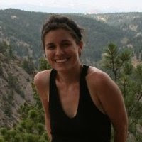
not us!
Just trying to make myself feel better...
I am watching the nightly news and they are showing tornado video from South Dakota...yesterday (something about spilled milk...I think there still are a few more days of mourning).
Today we drove from North Platte, NE to Garden City, KS to Scott City, KS to Leoti, KS to Colby, KS (time to brush up on your Kansas geography). There was minor blood shed this morning in the forecast discussion...Wyoming or Kansas?
Kansas. We targeted near the triple point. In this case the "triple point" is where the dry line and the warm front intersect. The dry line (usually N/S oriented) and the warm front are each different boundaries that separates different types of air masses (warm and dry--behind the dry line and warm and moist--behind the warm front). Also boundaries can provide directional shear (good for rotation).
Storms formed in southern Kansas and moved quickly north. We briefly deployed near Healy, KS (geography check), but the storms were immature. Storms began to fire along the dry line in southeast Colorado. We scrambled west to Leoti, KS to intercept storms moving north from the dryline. These storms just could not get themselves together (I am totally blaming the storms!)--they barely rotated and they never right-turned (the sign of a good, mature supercell).
I think House is coming on...Chase another day.
___________________________________________
Picture 1: Hi, Kansas.
Picture 2: The masses departing the morning weather briefing.
Picture 3: Lunch. Probe 12 had an unfortunate incident with a bird that went well with cranberry sauce...and made a nice sandwich the next day.
Picture 4: DOW7 postcard from Scott City, KS.


bingo canada
ReplyDeletetaruhan bola terpercayaStorms formed in southern Kansas and moved quickly north. We briefly deployed near Healy, KS (geography check), but the storms were immature. Storms began to fire along the dry line in southeast Colorado. We scrambled west to Leoti, KS to intercept storms moving north from the dryline. These storms just could not get themselves together (I am totally blaming the storms!)--they barely rotated and they never right-turned (the sign of a good, mature supercell).
bingo
ReplyDeleteราคาบอลวันนี้Kansas. We targeted near the triple point. In this case the "triple point" is where the dry line and the warm front intersect. The dry line (usually N/S oriented) and the warm front are each different boundaries that separates different types of air masses (warm and dry--behind the dry line and warm and moist--behind the warm front). Also boundaries can provide directional shear (good for rotation).
This comment has been removed by the author.
ReplyDeleteشركة تنظيف واجهات حجر بالرياض
ReplyDeleteافضل شركة تنظيف مساجد بالدمام
تنظيف خزانات بالرياض
شركة تنظيف بالبخار
شركة تنظيف موكيت بالرياض
نقل عفش بالرياض
شركة كشف تسربات المياه بالخرج
حراج الاثاث المستعمل بالرياض
تخزين اثاث
شركة تسليك بيارات بالرياض
شركة تنظيف بيوت بالرياض
شركة تنظيف سجاد المساجد بالدمام
نقل اثاث بالرياض
Your site is very helpful
ReplyDeletehttp://antiinsects.iwopop.com/
http://antiinsects.mex.tl/
https://antiinsects.1msite.com/
https://www.prokr.net/ksa/jeddah-water-leaks-detection-isolate-companies/
http://7asobi.com/
Smm panel
ReplyDeleteSmm Panel
Https://isilanlariblog.com
İNSTAGRAM TAKİPÇİ SATIN AL
hirdavatciburada.com
beyazesyateknikservisi.com.tr
Servis
jeton hile
Absolutely!
ReplyDeleteCongratulations on your article, it was very helpful and successful. 9e2df28a48c8bcede38bcb1e708f8515
ReplyDeletenumara onay
website kurma
sms onay
Thank you for your explanation, very good content. 6c7df51de28e50cb8fe3bf7870f0f5c1
ReplyDeletedefine dedektörü
Thanks for your article. 816963eaea90579594801e88d541a8c3
ReplyDeleteevden iş imkanı
demre
ReplyDeletedüzce
esenler
kütahya
sarıyer
X6İO
karabük
ReplyDeletetunceli
ardahan
giresun
ordu
KBX
salt likit
ReplyDeletesalt likit
T87H